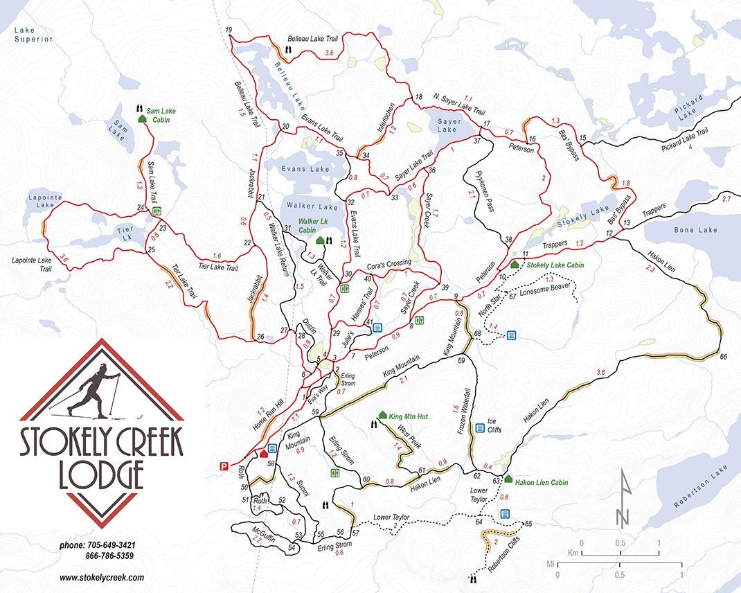
Our Trails
Experience Our Trails
Over 100km of trails are open year-round for low-impact recreational use including:
• bird watching and photography
• hiking and trail running
• skiing and snowshoeing
• biking
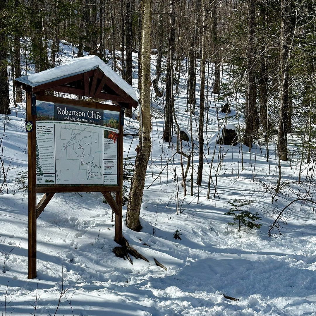
Our trails provide an opportunity to explore the Algoma Highlands, including the unique landscapes of Robertson Cliffs and King Mountain.

Trail Use Policy
To ensure everyone enjoys their time on Algoma Highlands Conservancy (AHC) trails, and to maintain harmonious relationships with the local communities, wildlife, and flora, we kindly ask you to adhere to our trail use policies:
- Our trails are open for silent sports recreation only. All forms of motorized access are prohibited.
- No camping or campfires!
- All AHC lands including Robertson Lake Road, are designated as a no drone zone. Please leave your drone at home.
- Fireworks are strictly prohibited.
- Cliff-based activities (rock climbing, bouldering, rappelling) are not permitted.
- Our trails cannot be used for events that require participant fees (such as hiking tours, trail running events, mountain biking events, educational tours) without a signed trail-use agreement to cover insurance requirements and a trail-use fee. Please contact us at least 4 weeks before the event.
Please note: trail cams are in place to monitor wildlife, trail conditions, and usage. Images of people are only used to tabulate trail usage.
Ski and snowshoe trails managed by
Stokely Creek Lodge